Karachi
| Karachi کراچی |
||
|---|---|---|
| Mega City / Metropolitan City | ||

Clockwise from top: Karachi Skyline, KPT HQ, PRC Towers & PNSC, Karachi Market, Manora Lighthouse, Nagan Interchange and MA Jinnah Tomb.
|
||
|
||
| Nickname(s): The Gateway to Pakistan, The City of Lights, Mini Pakistan, Capital of Sindh , The City Of Quaid | ||

Karachi
|
||
| Coordinates: 24°51′36″N 67°0′36″E / 24.86000°N 67.01000°ECoordinates: 24°51′36″N 67°0′36″E / 24.86000°N 67.01000°E | ||
| Country | ||
| Province | Sindh | |
| Metropolitan Corporation | 2011 | |
| City Council | City Complex, Gulshan-e-Iqbal Town | |
| Districts [3] | ||
| Government[7] | ||
| • Type | Metropolitan City | |
| • City administrator | Sajjad Hussain Abbasi[4] | |
| • Metropolitan commissioner | Samiuddin Siddiqui [5] | |
| • Commissioner | Shoaib Ahmed Siddiqui [6] | |
| Area[8] | ||
| • Total | 3,527 km2 (1,362 sq mi) | |
| Elevation | 8 m (26 ft) | |
| Population (2013) | ||
| • Total | 24,000,000[1][2] | |
| • Rank | 1st (Pakistan), 2nd (World) | |
| Demonym(s) | Karachiite | |
| Time zone | PKT (UTC+05:00) | |
| Postal codes | 74XXX – 75XXX | |
| Dialling code | +9221-XXXX XXXX | |
| Website | www |
|

Karachi (Sindhi: ڪراچي, Urdu: کراچی / ALA-LC: Karācī IPA: [kəˈrɑːˌtʃi] (![]() listen)) is the capital of the province of Sindh, as well as the largest and most populous metropolitan city of Pakistan. It is main port city of the country. Karachi is world's 6th largest metropolitan area.[1] It is the 2nd-largest city in the world by population.[9] It is also the main seaport and financial centre of the country. Karachi is also known as City of Lights mainly due to city's night life, for which it is famous as the city which never sleeps. Karachi metro has an estimated population of over 23.5 million people as of 2013,[2] and area of approximately 3,527 km2 (1,362 sq mi),[10][11] resulting in a density of more than 6,000 people per square kilometre (15,500 per square mile).[12]
listen)) is the capital of the province of Sindh, as well as the largest and most populous metropolitan city of Pakistan. It is main port city of the country. Karachi is world's 6th largest metropolitan area.[1] It is the 2nd-largest city in the world by population.[9] It is also the main seaport and financial centre of the country. Karachi is also known as City of Lights mainly due to city's night life, for which it is famous as the city which never sleeps. Karachi metro has an estimated population of over 23.5 million people as of 2013,[2] and area of approximately 3,527 km2 (1,362 sq mi),[10][11] resulting in a density of more than 6,000 people per square kilometre (15,500 per square mile).[12]
Karachi is the 7th largest[13] urban agglomeration in the world and the largest city in the Muslim world.[14] It is Pakistan's centre of banking, industry, economic activity and trade and is home to Pakistan's largest corporations, including those involved in textiles, shipping, automotive industry, entertainment, the arts, fashion, advertising, publishing, software development and medical research. The city is a hub of higher education in South Asia and the Muslim world.[15]
Karachi is also ranked as a beta world city.[16][17] It was the capital of Pakistan until Islamabad was constructed as a capital to spread development evenly across the country and to prevent it from being concentrated in Karachi.[18] Karachi is the location of the Port of Karachi and Port Bin Qasim, two of the region's largest and busiest ports. After the independence of Pakistan, the city population increased dramatically when hundreds of thousands of Muslim Muhajirs from India and from other parts of South Asia came to settle in Karachi.[19]
The city is located on the Arabian Sea coastline. It is also known as the Uroos ul Bilaad "The Bride of the Cities" and the "City of Lights",[20][21] for its liveliness,[citation needed] and the "City of the Quaid", having been the birth and burial place of Quaid-e-Azam, the Great Leader, Muhammad Ali Jinnah, the founder of Pakistan, who made the city his home after Pakistan's independence from the British Raj on 14 August 1947. According to PricewaterhouseCoopers, In 2009 Karachi had a total GDP of $78 billion with conservative projections expecting it to rise to $193 billion in 2025.[22]
Contents
History
Founding and Early History
The Late Palaeolithic and Mesolithic sites found by Karachi University team on the Mulri Hills, in front of Karachi University Campus, constitute one of the most important archaeological discoveries made in Sindh during the last fifty years. The last hunter-gatherers, who left abundant traces of their passage, repeatedly inhabited the Hills. Some twenty different spots of flint tools were discovered during the surface surveys.
Karachi was known to the ancient Greeks by many names: Krokola, the place where Alexander the Great camped to prepare a fleet for Babylonia after his campaign in the Indus Valley; Morontobara (probably Manora island near Karachi harbour), from whence Alexander's admiral Nearchus set sail; and Barbarikon, a port of the Bactrian kingdom. It was later known to the Arabs as Debal from where Muhammad bin Qasim led his conquering force into South Asia in AD 712.[23]
Karachi was reputedly founded as "Kolachi" by Baloch tribes from Balochistan and Makran, who established a small fishing community in the area.[24] Descendants of the original community still live in the area on the small island of Abdullah Goth, which is located near the Karachi Port. The original name "Kolachi" survives in the name of a well-known Karachi locality named Mai Kolachi in Balochi.
Mughal Empire
Mirza Ghazi Beg, the Mughal administrator of Sindh, is among the first historical figures credited for the development of coastal Sindh (consisting of regions such as the Makran coast and the Indus delta),[where?] including the cities of Thatta, Bhambore and Karachi. During the rule of the Mughal administrator of Sindh, Mirza Ghazi Beg the city was well fortified against Portuguese colonial incursions in Sindh. Debal and the Manora Island and was visited by Ottoman admiral Seydi Ali Reis and mentioned in his book Mir'ât ül Memâlik in 1554. The ancient names of Karachi included: Krokola, Barbarikon, Nawa Nar, Rambagh, Kurruck, Auranga Bandar, Minnagara, Kolachi, Morontobara, Kolachi-jo-Goth, Banbhore, Debal, Barbarice and Kurrachee.[25][26]
The village that later grew out of this settlement was known as Kolachi-jo-Goth (Village of Kolachi in Sindhi). By the late 1720s, the village was trading across the Arabian Sea with Muscat and the Persian Gulf region. The local Sindhi populace built a small fort, that was constructed for the protection of the city, armed with cannons imported by Sindhi sailors from Muscat, Oman. The fort had two main gateways: one facing the sea, known as Kharra Darwaaza (Brackish Gate) (Kharadar) and the other facing the Lyari River known as the Meet'ha Darwaaza (Sweet Gate) (Mithadar), which correspond to the modern areas of Kharadar and Mithadar.
The name Karachi was used for the first time in a Dutch document of 1742, when a merchant ship de Ridderkerk shipwrecked nearby its coast.[27][28]
The region continued to be ruled by the Talpur Amir's of Sindh who remained under nominal suzerainty of the Mughals till 1843.
British Raj

After some exploratory missions to the area, the British East India Company captured the town when HMS Wellesley anchored off Manora island on 1 February 1839. Two days later, the little fort surrendered.[29] The town was later annexed to British East India Company held territories in India when parts of Sindh was captured by Major General Charles James Napier after their victory in the Battle of Miani on 17 February 1843.
On his departure in 1847, Napier is said to have remarked, "Would that I could come again to see you in your grandeur!" Karachi was made the capital of Sindh after British victory in 1843. On Napier's departure, it was added along with the rest of Sindh to the Bombay Presidency, a move that caused resentment among the native Sindhis. The British realised the importance of the city as a military cantonment and as a port for exporting the produce of the Indus River basin, and developed its harbour for shipping. The foundations of a city municipal government were laid down and infrastructure development was undertaken. New businesses opened up and the population of the town began rising.
The arrival of the troops of the Company Bahadur in 1843 spawned the foundation of the new section, the military cantonment. The cantonment formed the basis of the 'white' town, where the local population had limited access. This town was modelled after English industrial parent-cities, where work and residential spaces were separated, as were residential from recreational places. The 'native' town in the northwest, was enlarged to accommodate the burgeoning mercantile population. When the Indian Rebellion of 1857 broke out in South Asia, the 21st Native Infantry, then stationed in Karachi, declared allegiance to rebels and joining their numbers on 10 September 1857. Nevertheless, the British were able to quickly reassert control over Karachi and defeat the uprising. Officer William 'Waf' Frost was considered to be instrumental in quelling the rebellion and was rewarded for his valor with an Order of the British Empire. This was awarded to him on 23 April 1858. However, he remains unpopular in areas of Karachi to this day.

In 1864, the first telegraphic message was sent from South Asia to England, when a direct telegraph connection was laid between Karachi and London.[30] In 1878, the city was connected to the rest of British India by rail. Public building projects, such as Frere Hall (1865) and the Empress Market (1890), were undertaken. In 1876, Muhammad Ali Jinnah, the founder of Pakistan, was born in the city according to some accounts, which by now had become a bustling city with mosques, temples, courthouses, paved streets and a harbour. By 1899, Karachi had become the largest wheat exporting port in the East.[31] Before 1880 the majority of the population of Karachi consisted of the indigenous Sindhis and Balochis (who also spoke Sindhi as a second language).
These developments in Karachi resulted in an influx of economic migrants: Parsis, Hindus, Christians, Jews, Marathis, Goan Christian, Chinese, British, Arabs and Gujaratis. The population of the city was about 105,000 inhabitants by the end of the 19th century, with a mix of nationalities. British colonialists embarked on works of sanitation and transportation – such as gravel paved streets, drains, street sweepers, and a network of Trams and horse-drawn trolleys.
Karachi Post-Independence
By the time of Pakistan's independence in 1947, Karachi had become a bustling metropolis with slightly under half a million people, and classical and colonial European styled buildings lining the city's thoroughfares. Karachi was chosen as the capital of Pakistan, which at the time included present-day Bangladesh, approximately 1,000 km (620 mi) to the east, and not physically connected to Pakistan. In 1947, Karachi was the focus for settlement by Muslim Muhajirs fleeing from the anti-Muslim pogroms in India, who expanded the city's population and transformed its demographics and economy.

In 1958, the capital of Pakistan was moved from Karachi to Rawalpindi. The foreign embassies in Karachi moved to the newly developed capital Islamabad, near Rawalpindi. There are Consulates and Honorary Consulates as Diplomatic missions in Karachi.
During the 1960s, Karachi was seen as an economic role model around the world. Many countries sought to emulate Pakistan's economic planning strategy and one of them, South Korea, copied the city's second "Five-Year Plan" and the World Financial Center in Seoul is designed and modeled after Karachi.[32][33] Karachi had both a municipal corporation and a Karachi Divisional Council in the 1960s, which developed schools, colleges, roads, municipal gardens, and parks. The Karachi Divisional Council had working committees for education, roads, and residential societies development and planning.[34] In the late 1960s, the capital shifted from Rawalpindi to the newly built Islamabad. This marked the start of a long period of decline in the city, marked by a lack of development.
The 1970s also saw major labour struggles in Karachi's industrial estates. The 1980s and 1990s saw an influx of thousands of Afghan refugees from the Soviet war in Afghanistan into Karachi; they were followed in smaller numbers by refugees escaping from Iran.[35] Karachi ethnic groups included: Muhajirs, Sindhis, Punjabis, Kashmiris, Seraikis, Pakhtuns, Balochis, Memons, Bohras, Ismailis, etc. After the 1970s Karachi has become home to about five to seven million Pashtuns, which is more than Khyber Pakhtunkhwa.[36][37] In the late 1980s and early 1990s, ethnic and political violence broke out across the city between Muhajir followers of the Mohajir Qaumi Movement fought with ethnic Sindhis, Pashtuns, Punjabis, and security forces. As a result, the Army was deployed to restore peace in the city.[38]
Today, Karachi is an important financial and industrial centre and handles most of the overseas trade of Pakistan and the world, mainly the Asian countries. It accounts for a significant share of the GDP of Pakistan.[39]
Geography

City geographic coordinates are 24°51′ N 67°02′ E. Most of the land consisted largely of flat or rolling plains, with hills on the western and Manora Island and the Oyster Rocks. The Arabian Sea beach lines the southern coastline of Karachi. Mangroves and creeks of the Indus delta can be found toward the southeast side of the city. Toward the west and the north is Cape Monze, locally known as Ras Muari, an area marked by projecting sea cliffs and rocky sandstone promontories. Some excellent beaches can be found in this area. Khasa Hills and Mulri Hills lie in the northwest and form the border between North Nazimabad Town[40] and Orangi Town. The Manghopir Hills lies northwest of Karachi, between Hub River and Manghopir. The hills in Karachi are the offshoots of the Kirthar Range. The highest point of these hills in Karachi is about 528m in the extreme north. All these hills are devoid of vegetation and have wide intervening plains, dry river beds and water channels.[41] The rivers in Karachi are Malir River and Lyari River. The Indus River flood plain is near Karachi. The city is located on the Arabian Sea coastline. It is known as the Uroos ul Bilaad "The Bride of the Cities" and the "City of Lights",[20][21] for its liveliness,[citation needed] and the "City of the Quaid", having been the birth and burial place of Quaid-e-Azam, the Great Leader, Muhammad Ali Jinnah, the founder of Pakistan, who made the city his home after Pakistan's independence from the British Raj on 14 August 1947.
Climate
Located on the coast, Karachi has an arid climate with low average precipitation levels (approx. 250 mm (9.8 in) per annum), the bulk of which occurs during the July–August monsoon season. Winters are warm and dry, while the summers are hot and humid; the proximity to the sea maintains humidity levels at a near-constant high and cool sea breezes relieve the heat of the summer months. December and January are dry and pleasant as compared to the warm summers that dominate through the late spring (March) to the pre-monsoon season (June). Compared to other parts of Pakistan, Karachi's weather is considered mild and can be compared to Florida's weather (except for the precipitation).
The city's highest monthly rainfall, 429.3 mm (16.90 in), occurred in July 1967.[42] The city's highest rainfall in 24 hours occurred on 7 August 1953, when about 278.1 millimetres (10.95 in) of rain lashed the city, resulting in major flooding.[43] Karachi's highest recorded temperature is 47 °C (117 °F), which was recorded on 18 June 1979,[42] and the lowest is 0.0 °C (32.0 °F), recorded on 21 January 1934.[42]
| Climate data for Karachi | |||||||||||||
|---|---|---|---|---|---|---|---|---|---|---|---|---|---|
| Month | Jan | Feb | Mar | Apr | May | Jun | Jul | Aug | Sep | Oct | Nov | Dec | Year |
| Record high °C (°F) | 32.8 (91) |
36.1 (97) |
41.5 (106.7) |
44.4 (111.9) |
47.8 (118) |
47.0 (116.6) |
42.2 (108) |
41.7 (107.1) |
42.8 (109) |
43.3 (109.9) |
38.5 (101.3) |
34.5 (94.1) |
47.8 (118) |
| Average high °C (°F) | 25.8 (78.4) |
27.7 (81.9) |
31.5 (88.7) |
34.3 (93.7) |
35.2 (95.4) |
34.8 (94.6) |
33.1 (91.6) |
31.7 (89.1) |
32.6 (90.7) |
34.7 (94.5) |
31.9 (89.4) |
27.4 (81.3) |
31.7 (89.1) |
| Daily mean °C (°F) | 18.1 (64.6) |
20.2 (68.4) |
24.5 (76.1) |
28.3 (82.9) |
30.5 (86.9) |
31.4 (88.5) |
30.3 (86.5) |
28.9 (84) |
28.9 (84) |
27.9 (82.2) |
23.9 (75) |
19.5 (67.1) |
26.0 (78.8) |
| Average low °C (°F) | 10.4 (50.7) |
12.7 (54.9) |
17.6 (63.7) |
22.3 (72.1) |
25.9 (78.6) |
27.9 (82.2) |
27.4 (81.3) |
26.1 (79) |
25.2 (77.4) |
21.0 (69.8) |
15.9 (60.6) |
11.6 (52.9) |
20.3 (68.5) |
| Record low °C (°F) | 0.0 (32) |
3.3 (37.9) |
7.0 (44.6) |
12.2 (54) |
17.7 (63.9) |
22.1 (71.8) |
22.2 (72) |
20.0 (68) |
18.0 (64.4) |
10.0 (50) |
6.1 (43) |
1.3 (34.3) |
0.0 (32) |
| Average rainfall mm (inches) | 6.0 (0.236) |
9.8 (0.386) |
11.7 (0.461) |
4.4 (0.173) |
0.0 (0) |
5.5 (0.217) |
85.5 (3.366) |
67.4 (2.654) |
19.9 (0.783) |
1.0 (0.039) |
1.8 (0.071) |
4.4 (0.173) |
217.4 (8.559) |
| Mean monthly sunshine hours | 270.7 | 249.4 | 271.6 | 277.4 | 299.1 | 231.8 | 155.0 | 147.7 | 218.8 | 283.5 | 273.3 | 272.0 | 2,950.3 |
| Source #1: NOAA[44] | |||||||||||||
| Source #2: PMD (extremes)[45] | |||||||||||||
Cityscape

The oldest portions of Karachi were laid out in a manner typical of cities in South Asia. A small settlement developed around the present day neighborhood of Mithadar. This original portion of the city was encircled by a short wall. When the British conquered Sindh in the 19th century, Karachi witnessed explosive growth. Initially the areas around Mithadar, such as Kharadar, Jodia Bazar, and Sarafa Bazar were to witness growth and development along the lines of growth in the earlier Mithadar neighborhood - that is, with narrow winding streets with shops on the ground floors of buildings, and warehouse and living quarters above. Several of the streets in these areas reflect the area's formerly strong Hindu influences, such as Daryalal Street, Ram Bharti Street, and Virjee Street. Rapid growth ensued after the British laid out the spacious and sprawling Karachi Cantonment to the east of the so-called "Native Town." As the British expanded their rule in Sindh, they set out to create grand civic buildings. Examples such as the Karachi Municipal Corporation building, and the Karachi Port Trust Building were located in the "Native Town," while other buildings such as the Diwan Dayaram Jethamal Science College, and Frere Hall from 1865 were built in the colonial administrative center. The British also built large churches in the city, such as the St. Patrick's Cathedral.

As the British presence grew in the area, the native population expanded as the city became an important trading center. The areas to the north and northeast of the city grew rapidly without urban planning, resulting in the regions of Karachi today comprising Lyari Town. To the north of the colonial center grew fashionable neighborhoods for Karachi's wealthy natives in places such as Garden. The British also developed the neighborhoods of Clifton and Bath Island around this time as wealthy sea-side suburbs. Wealthy natives bestowed the city with some of its finest architecture after 1900. Examples of this include the Karachi Gymkhana, the Hindu Gymkhana, and the Mohatta Palace. Public works were also commissioned by natives, one such example being the Jehangir Kothari Parade - built in 1921 by a wealthy Zoroastrian (Parsi) Karachiite.

On the Eve of the independence, the town was clearly delineated between three portions. The first was the "Native Town" centered on Mithadar, Kharadar, Manora Island, and Lyari town where much of the local population lived in cramped quarters. The second area was almost exclusively for European residents, and was centered on Saddar, the Cantonment, and Clifton. The third area was for wealthy and educated natives who were centered in the Garden districts north of the city. Karachi's grand civic monuments were located primarily in the Native Town and in the European quarters, while the commercial heart of the city was centered on Saddar and the Bandar Road.
Following independence, and the massive influx of Muslim refugees who fled from anti-Muslim pograms in India, the city required that large swathes of land on the outskirts of the city be turned into tent-cities for the new refugee population. The Muslim refugees struggled and slowly gained a foothold in the business community that had been left vacant by departing Hindus. New middle-class neighborhoods were laid out with wide boulevards from the 1950s-1970s in places such as Nazimabad, while tracts of single family homes developed in the eastern and southeast parts of the city in a large area known as Civil Defence. Lower classes crammed further into Lyari town, and expanded into the outlying lower-middle class areas of Orangi Town in the 1960s-1990s. Slums began to also arise, especially in the Lyari, Korangi, Keamari, and eastern parts of Orangi township, and are known by the local term "Katchi Abadis."
As Karachi descended into ethnic and political strife in the 1990s, large numbers of middle class Karachiites began to leave the central portions of the city, leaving areas in the original "Native Town" to deteriorate. New and sprawling townships arose at the peripheries of the city, and continued to spread outwards from places like North Karachi to Surjani Town. Despites a sharp drop in crime compared to the 1990s, the exodus of middle-class families continues, although neighborhoods such as Clifton and Garden have made a turn around and are now once again centers of new development aimed at the ever expanding middle class of Pakistan.
Economy

Karachi is the financial and commercial capital of Islamic Republic of Pakistan.[46] In line with its status as a major port and the country's largest metropolis, it accounts for a lion's share of Pakistan's revenue. According to the Federal Board of Revenue's 2006–2007 year book, tax and customs units in Karachi were responsible for 46.75% of direct taxes, 33.65% of federal excise tax, and 23.38% of domestic sales tax.[47] Karachi accounts for 75.14% of customs duty and 79% of sales tax on imports.[47] Therefore, Karachi collects 53.38% of the total collections of the Federal Board of Revenue, out of which 53.33% are customs duty and sales tax on imports.[47] (Note: Revenue collected from Karachi includes revenue from some other areas since the Large Tax Unit (LTU) Karachi and Regional Tax Offices (RTOs) Karachi, Hyderabad, Sukkur & Quetta cover the entire province of Sindh and Balochistan).[47] Karachi's indigenous contribution to national revenue is around 25%.[39]

Karachi's contribution to Pakistan's manufacturing sector amounts to approximately 30 percent.[48] A substantial part of Sindh's gross domestic product (GDP) is attributed to Karachi[49][50] (the GDP of Sindh as a percentage of Pakistan's total GDP has traditionally hovered around 28%–30%; for more information, see economy of Sindh).[49][50][51][52] Karachi's GDP is around 20% of the total GDP of Pakistan.[39][53] A PricewaterhouseCoopers study released in 2009, which surveyed the 2008 GDP of the top cities in the world, calculated Karachi's GDP (PPP) to be $78 billion[22] (projected to be $193 billion in 2025 at a growth rate of 5.5%).[22] It confirmed Karachi's status as Pakistan's largest economy, well ahead of the next two biggest cities Lahore and Faisalabad, which had a reported GDP (PPP) in 2008 of $40 billion and $14 billion, respectively.[22] Karachi's high GDP is based on its industrial base, with a high dependency on the financial sector. Textiles, cement, steel, heavy machinery, chemicals, food, banking and insurance are the major segments contributing to Karachi's GDP. In February 2007, the World Bank identified Karachi as the most business-friendly city in Pakistan.[54]
Karachi is the nerve center of Pakistan's economy. The economic stagnation caused by political anarchy, ethnic strife and resultant military operation during the late 1980s and 1990s led to an exit of industry from Karachi. Most of Pakistan's public and private banks are headquartered on Karachi's I. I. Chundrigar Road; according to a 2001 report, nearly 60% of the cashflow of the Pakistani economy takes place on I. I. Chundrigar Road. Most major foreign multinational corporations operating in Pakistan have their headquarters in Karachi. The Karachi Stock Exchange is the largest stock exchange in Pakistan, and is considered by many economists to be one of the prime reasons for Pakistan's 8% GDP growth across 2005.[55] A recent report by Credit Suisse on Pakistan's stock market is a testimonial to its strong fundamentals, estimating Pakistan's relative return on equities at 26.7 percent, compared to Asia's 11 percent.[56]
Karachi has seen an expansion of information and communications technology and electronic media and has become the software outsourcing hub of Pakistan. Call centres for foreign companies have been targeted as a significant area of growth, with the government making efforts to reduce taxes by as much as 10% to gain foreign investments in the IT sector.[57][58] Many of Pakistan's independent television and radio stations are based in Karachi, including world-popular Business Plus, AAJ News, Geo TV, KTN,[59] Sindh TV,[60] CNBC Pakistan, TV ONE, ARY Digital, Indus Television Network, Samaa TV and Dawn News, as well as several local stations.
Karachi has large industrial zones such as Karachi Export Processing Zone, SITE, Korangi, Northern Bypass Industrial Zone, Bin Qasim and North Karachi, located on the fringes of the main city.[61] Its primary areas of industry are textiles, pharmaceuticals, steel, and automobiles. In addition, Karachi has a cottage industry and there is a Free Zone with an annual growth rate of nearly 6.5%. The Karachi Expo Centre hosts regional and international exhibitions.[62]
| Name of Estate | Location | Established | Area in acres |
|---|---|---|---|
| SITE Karachi | SITE Town | 1947 | 4700[63] |
| Korangi Industrial Area | Korangi Town | 1960 | 8500[64] |
| Landhi Industrial Area | Landhi Town | 1949 | 11000[65] |
| North Karachi Industrial Area | New Karachi Town | 1974 | 725[66] |
| Federal B Industrial Area | Gulberg Town | 1987 | [67] |
| Korangi Creek Industrial Park | Korangi Creek Cantonment | 250[68] | |
| Bin Qasim Industrial Zone | Bin Qasim Town | 1970 | 25000[69] |
| Karachi Export Processing Zone | Landhi Town | 1980[70] | 315[71] |
| Pakistan Textile City | Bin Qasim Town | 2004 | 1250[72] |
| West Wharf Industrial Area | Keamari Town | 430 | |
| SITE Super Highway Phase-I | Super Highway | 1983 | 300[73] |
| SITE Super Highway Phase-II | Super Highway | 1992 | 1000[73] |
There are development projects proposed, approved and under construction in Karachi. Among projects of note, Emaar Properties is proposing to invest $43bn (£22.8bn) in Karachi to develop Bundal Island, which is a 12,000 acres (49 km2) island just off the coast of Karachi.[74] The Karachi Port Trust is planning a Rs. 20 billion, 1,947 feet (593 m) high Port Tower Complex on the Clifton shoreline.[75][76] It will comprise a hotel, a shopping center, an exhibition center and a revolving restaurant with a viewing gallery offering a panoramic view of the coastline and the city.[77]
Civic administration


The first form of government was a conservancy board established in 1846 to control the spread of cholera in the city.[78] The board became a municipal commission in 1852, and a municipal committee the following year.[78] The City of Karachi Municipal Act of 1933 transformed the city administration into a municipal corporation with a mayor, a deputy mayor and 57 councillors.[78] In 1948, the Federal Capital Territory of Pakistan was created, comprising approximately 2,103 km2 (812 sq mi) of Karachi and surrounding areas, but this was merged into the province of West Pakistan in 1961.[79] However, the municipal corporation remained in existence and in 1976 became a metropolitan corporation, followed by the creation of zonal municipal committees, which lasted until 1994.[78] Two years later the metropolitan area was divided into five districts, each with a municipal corporation.[78]
In 2001, five districts of Karachi were merged to form the city district of Karachi. It was structured as a three-tier federation, with the two lower tiers composed of 18 towns and 178 union councils,[80] with each tier focused on elected councils with some common members to provide "vertical linkage" within the federation.[81] Each union council comprised thirteen members elected from specified electorates: four men and two women elected directly by the general population; two men and two women elected by peasants and workers; one member for minority communities; two members are elected jointly as the union mayor (nazim) and deputy union mayor (naib nazim).[82] Each town council comprised the deputy union mayors in the town as well as elected representatives for women, peasants and workers, and minorities.[83] The district council comprised all of the union mayors in the district as well as elected representatives for women, peasants and workers, and minorities.[84] Each council was also included up to three council secretaries and a number of other civil servants. Naimatullah Khan was the first Nazim of Karachi and Shafiq-Ur-Rehman Paracha was the first district co-ordination officer (DCO) of Karachi, Paracha even served as the last Commissioner of Karachi. Syed Mustafa Kamal was elected City Nazim of Karachi to succeed Naimatullah Khan in 2005 elections, and Nasreen Jalil was elected as the City Naib Nazim.
Again in 2011, City District Government of Karachi has been de-merged into its five original constituent districts namely Karachi East, Karachi West, Karachi Central, Karachi South and Malir. In November 2013, another district, "Korangi" carved out from District East after which the number of districts in Karachi rose to Six. So there are now six administrative districts in Karachi.[85][86][87][88][89] City administrator is Muhammad Hussain Syed[90] and Municipal Commissioner of Karachi is Matanat Ali Khan.[91] The position of Commissioner of Karachi was created and Shoaib Ahmad Siddiqui was appointed as the Commissioner of Karachi.[92] There are also six military cantonments which are administered by the Military.
 |
|
Demographics
Karachi's inhabitants, locally known as Karachiites, are composed of ethno-linguistic groups from all parts of Pakistan, as well as migrants from South Asia, making the city's population a diverse melting pot. At the end of the 19th century, the population of the city was about 105,000, with a gradual increase over the next few decades, reaching more than 400,000 on the eve of independence. Estimates of the population range from 15 to 18 million,[93][94] of which an estimated 90% are migrants from different backgrounds. The city's population is estimated to be growing at about 5% per year (mainly as a result of internal rural-urban migration), including an estimated 45,000 migrant workers coming to the city every month from different parts of Pakistan.[95]
The earliest inhabitants of the area that became Karachi were Sindhi tribes such as the Jokhio, Mallaah and Jat in the east and Baloch in the west and. Before the end of British colonial rule and the subsequent independence of Pakistan in 1947, the population of the city was majority Sindhi and Baloch Muslims, Hindus and Sikhs, but the community is still present numbering around 250,000 residents.[96]
-

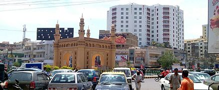
A view of Karachi downtown, the capital of Sindh province
-
Charminar Chowrangi, Bahadurabad is one of Karachi's densely populated areas largely developed in early 1960's
-
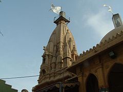
200-year-old Shri Swaminarayan Temple in central Karachi. Karachi has one of the world's largest Hindu communities outside of India with a population of around 250,000 people.


| Rank | Language | 1998 census[97] | Speakers | 1981 census | Speakers |
|---|---|---|---|---|---|
| 1 | Urdu | 48.52% | 4,497,747 | 54.34% | 2,830,098 |
| 2 | Punjabi (incl. Saraiki dialect) |
16.05% | 1,488,016 | 13.99% | 728,617 |
| 3 | Pashto | 11.42% | 2,158,650 | 8.71% | 453,628 |
| 4 | Sindhi | 7.22% | 669,340 | 6.29% | 327,591 |
| 5 | Balochi | 4.34% | 402,386 | 4.39% | 228,636 |
| Others | 12.44% | 1,153,126 | 12.27% | 639,560 | |
| All | 100% | 9,269,265 | 100% | 5,208,132 |
| Population growth | |||
|---|---|---|---|
| Census | Pop. | %± | |
| 1881 | 73,560 |
|
|
| 1891 | 105,199 | 43.0% | |
| 1901 | 136,297 | 29.6% | |
| 1911 | 186,771 | 37.0% | |
| 1921 | 244,162 | 30.7% | |
| 1931 | 300,799 | 23.2% | |
| 1941 | 435,887 | 44.9% | |
| 1951 | 1,068,459 | 145.1% | |
| 1961 | 1,912,598 | 79.0% | |
| 1972 | 3,426,310 | 79.1% | |
| 1981 | 5,208,132 | 52.0% | |
| 1998 | 9,339,023 | 79.3% | |
| Source:[98][93] †Huge population rise between 1941 and 1951 due to large scale migration after independence in 1947 |
|||

The city was, and still is home to a large community of Gujarati Muslims who were one of the earliest settlers in the city, and still form the majority in Saddar Town. Important Gujarati Muslim communities in the city include the Memon, Chhipa, Ghanchi, Khoja, Bohra and Tai.
Other early settlers included the Marwari Muslims, Parsis, Marathi Muslims and Konkani Muslims from Maharashtra (settled in Kokan Town), Goan Catholics and Anglo-Indians. Most non-Muslims left the city to India in the 1950s, after independence, but there are still small communities of Parsis, Goan Catholics and Anglo-Indians in the city.
The independence of Pakistan in 1947 saw the influx of Muslim Muhajirs from India fleeing from anti-Muslim pograms. The majority of the Urdu-speaking and other non-Punjabi Muslim refugees that fled from various Indian states settled in Karachi, which is why the culture of the city is a blend of South Asia. Most of the property vacated by non-Muslims, who left Karachi due to the new settlements made by these refugees, were granted to Muslim refugees through claims on behalf of the property they claimed leaving behind in India.[99] Today, the descendants of these Muslim refugees are known as Muhajirs and form a large, powerful group in Karachi. These Muhajirs include Urdu, Gujarati, Marathi, Konkani, Rajasthani, and Malabari Muslims from India. After the Indo-Pakistani War of 1971, thousands of Biharis and Bengalis from Bangladesh arrived in the city, and today Karachi is home to 1 to 2 million ethnic Bengalis from Bangladesh (see Bangladeshis in Pakistan),[100][101] many of whom migrated in the 1980s and 1990s. They were followed by Rohingya Muslim refugees from western Burma (for more information, see Burmese people in Pakistan),.[102][103] These small ethno-linguistic groups are being assimilated in the Urdu-speaking community.[99]
Karachi is host to many Western expatriates in Pakistan including Asian refugees from Uganda. One under-privileged sub-ethnic group is the Siddis (Africans – Sheedi) who are now naturalised Sindhi speakers. They are descended from African slaves.[104] Many other refugees from Iran (who stayed till the late 1980s) and the Central Asian countries constituting the former Soviet Union have also settled in the city as political or economic migrants. A large numbers of Arabs, Filipinos and an economic elite of Sinhalese from Sri Lanka.[105] Expatriates from China have a history going back to the 1940s; today, many of the Chinese are second-generation children of immigrants who came to the city and worked as dentists, chefs and shoemakers.[105][106]
During World War II, about 3,000 Polish refugees from the Soviet Union were evacuated to Karachi by the British. Some of these Polish families settled permanently in the city.[107][108] There are also communities of American[109] and British expatriates.
After the independence of Pakistan, a considerable number of Punjabi Muslims from Pakistani Punjab settle in Karachi. Punjabi and Pashtun are two out of three major ethnic groups in Karachi. The Pashtuns, originally from the province of Khyber Pakhtunkhwa, Federally Administered Tribal Areas and northern Balochistan, are settled in Karachi post independence. Additionally several Afghan Pashtun refugees settled in Karachi during the 80's.[36][37] including 50,000 registered Afghan refugees in the city,[110][111][111][112] There is also a sizeable community of Kashmiri Muslims from the Kashmir Valley.[113]
According to the last official census of the city, which was held in 1998, the linguistic distribution of the city was: Urdu: 48.52%; Punjabi: 16.05%; Pashto: 25.01%; <Sindhi: 7.22%; Balochi: 4.34%; others: 12.44%. The others include Dari, Gujarati, Dawoodi Bohra, Memon, Marwari, Brahui, Makrani, Hazara, Khowar, Burushaski, Arabic, Farsi and Bengali.[114]
Urdu is the spoken language of Karachi. English is spoken by the city's white collar workforce. Sindhi and Balochi are spoken in Lyari Town and small neighborhood that were previously small villages and became part of expanding Karachi. Karachi has become the largest Pashto city in the world. Punjabi is also spoken in Karachi.
Tourist attractions
Karachi is a tourist destination for domestic and international tourists. Some tourist attractions near Karachi city are:
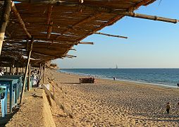
Beaches: The beaches of Karachi are the main attraction for tourists. There are many beautiful seasides near city like Seaview, Manora Island, Sandspit Beach, Hawke's Bay Beach, Paradise Point, French Beach, Cape Monze, and Nathiagali Beach.

-
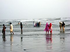
Karachi Beach
-

Bagh Ibne Qasim


Museums: The main museum of Karachi is National Museum of Pakistan others are Pakistan Air Force Museum and Pakistan Maritime Museum.
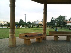
Parks: Some popular parks are Bagh Ibne Qasim, Boat Basin Park, Mazar-e-Quaid, Karachi Zoo, Hill Park, Safari Park, Bagh-e-Jinnah, PAF Museum Park and Maritime Museum Park.
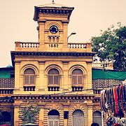
Historic places and buildings: Chowkandi graveyard is the most historic place in Karachi, famous for hundred-year old tombs. Historic buildings in the city were constructed in the British era like Karachi Port Trust, Sindh High Court. Hindu Gymkhana, KMC Head Office, Ghulam Husain Khalikdina Hall, Frere Hall, Empress Market, Jehangir Kothari Parade, St Patrick's Church, Mohatta Palace and Karachi Cantonment Railway Station buildings.[115]
Lake and National Park: Hub lake is 56 kilometres away in north of Karachi. It is an ideal place to birds watching, picnic, swimming and fishing. The Kirthar National Park is also located near this lake. The park is the home of Striped hyenas, Wolves, Ratels, Urials, Indian Gazelles and Sind wild goats.
Art and culture
-

3 Talwar (Swords), Clifton, Karachi


_Clifton,_Karachi.jpg)

Karachi is home to some of Pakistan's important cultural institutions. The National Academy of Performing Arts,[116] located in the newly renovated Hindu Gymkhana, offers a two-year diploma course in performing arts that includes classical music and contemporary theatre. The All Pakistan Music Conference, linked to the 45-year-old similar institution in Lahore, has been holding its annual music festival since its inception in 2004.[117] The National Arts Council (Koocha-e-Saqafat) has musical performances and mushaira (poetry recitations). The Kara Film Festival annually showcases independent Pakistani and international films and documentaries. Karachi is home to theatre, music and dance performance groups, such as Thespianz Theater, a professional youth-based, non-profit performing arts group, which works on theatre and arts activities in Pakistan.[citation needed] A website serving the Pakistani fashion industry is FORMA.pk. Karachi has museums that present exhibitions on a regular basis, including the Mohatta Palace and the National Museum of Pakistan. Karachi Expo Centre hosts regional and international exhibitions.
The everyday lifestyle of Karachi differs from that of other Pakistani cities and towns. The culture of Karachi is characterised by the blending of South Asian, Middle Eastern, Central Asian and Western influences, as well as its status as a major international business centre. After the independence of Pakistan, Karachi received refugees from all over India, whose influence is now evident in the city's sub-cultures.[citation needed]
Architecture
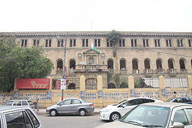
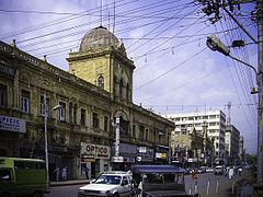
Karachi has a collection of buildings and structures of varied architectural styles. The downtown districts of Saddar and Clifton contain early 20th-century architecture, ranging in style from the neo-classical KPT building to the Sindh High Court Building. During the period of British rule, classical architecture was preferred for monuments of the British Raj.[citation needed] Karachi acquired its first neo-Gothic or Indo-Gothic buildings when Frere Hall, Empress Market and St. Patrick's Cathedral were completed. The Mock Tudor architectural style was introduced in the Karachi Gymkhana and the Boat Club. Neo-Renaissance architecture was popular in the 19th century and was the language for St. Joseph's Convent (1870) and the Sind Club (1883).[118] The classical style made a comeback in the late 19th century, as seen in Lady Dufferin Hospital (1898)[119] and the Cantt. Railway Station. While Italianate buildings remained popular, an eclectic blend termed Indo-Saracenic or Anglo-Mughal began to emerge in some locations.
The local mercantile community began acquiring impressive structures. Zaibunnisa Street in the Saddar area (known as Elphinstone Street in British days) is an example where the mercantile groups adopted the Italianate and Indo-Saracenic style to demonstrate their familiarity with Western culture and their own. The Hindu Gymkhana (1925) and Mohatta Palace are examples of Mughal revival buildings.[120] The Sindh Wildlife Conservation Building, located in Saddar, served as a Freemasonic Lodge until it was taken over by the government. There are talks of it being taken away from this custody and being renovated and the Lodge being preserved with its original woodwork and ornate wooden staircase.[121]
Indus Valley School of Art and Architecture is one of the prime examples of Architectural conservation and restoration where an entire Nusserwanjee building from Kharadar area of Karachi has been relocated to Clifton for adaptive reuse in an art school. The procedure involved the careful removal of each piece of timber and stone, stacked temporarily, loaded on the trucks for transportation to the Clifton site, unloaded and re-arranged according to a given layout, stone by stone, piece by piece, and completed within three months.[122]
Architecturally distinctive, even eccentric, buildings have sprung up throughout Karachi. Notable example of contemporary architecture include the Pakistan State Oil Headquarters building. The city has examples of modern Islamic architecture, including the Aga Khan University hospital, Masjid e Tooba, Faran Mosque, Bait-ul Mukarram Mosque, Quaid's Mausoleum, and the Textile Institute of Pakistan. One of the unique cultural elements of Karachi is that the residences, which are two- or three-story townhouses, are built with the front yard protected by a high brick wall. Ibrahim Ismail Chundrigar Road features a range of extremely tall buildings. The most prominent examples include the Habib Bank Plaza, PRC Towers and the MCB Tower which is the tallest skyscraper in Pakistan.[123]
Many High-rise buildings are under construction, such as Centre Point near Korangi Industrial Area, IT Tower, Sofitel Tower Karachi and Emerald Tower. The Government of Sindh recently[when?] approved the construction of two high-density zones, which will host the new city skyline.
Art Galleries
There are many art galleries in Karachi for the exhibition of art especially the visual art.
Food & Cuisine
Biryani is arguably the most popular food among Karachiites, with numerous variants (Awadhi, Mughlai, Bombay, Sindhi, Memoni etc.). Chicken biryani is the most popular edible food item in Karachi. In addition to chicken biryani, beef biryani is also famous. It is worthwhile to mention here that chicken biryani is a mandatory food item in every wedding reception in Karachi.[citation needed]. Karachi is also famous for Hyderabadi cuisine. In fact, a suburb called Hyderabad Colony consists of a series of restaurants that serve hyderbadi food. It includes bagharay began, hyderbadi zaafran biryani, kachay gosht ki biryani, hyderabdi achaar, hyderabadi chatnai and famous hyderabadi sweet dishes like khhobani ka meetha and double ka meetha. Meat curries such as nihari and haleem, dal (lentils), barbecue dishes are also very popular, however cuisines vary from one neighbourhood to another, given the diverse nature of ethnic origins that exist. Karachi has a large number of restaurants from local and fast food to a wide variety of international cuisines such as (Italian, Chinese, Japanese, Arab, Korean, South Indian, etc.). The Port Grand Food and Entertainment Complex is the largest food street of Asia.[citation needed] The project is a 13-acre facility. Boat Basin is a famous food market while Do Darya is another new location with lots of famous restaurant outlets. Burns Road in Saddar is one of the oldest food streets of city and is still the most popular place to find traditional Pakistani food. The Cuisine of Karachi includes rice cooked with fish called Sindhi fish biryani and a pancake made with rice flour which now only exist in the fishing communities in Baba Bhit Island.
Sports


When it comes to sports Karachi has a distinction, because some sources cite that it was in 1877 at Karachi in (British) India, where the first attempt was made to form a set of rules of badminton[124] and likely place is said to Frere Hall.
Cricket in Pakistan has a history of even before the creation of the country in 1947. The first ever international cricket match in Karachi was held on 22 November 1935 between Sindhi and Australian cricket teams. The match was seen by 5,000 Karachiites. It is also the most popular sport in Karachi today, which is played in many small grounds around the city, as well as on city streets at night and on weekends. Gully cricket is played in the narrow by-lanes of the city.
The National Stadium is the city's only world-class cricket stadium, and is the second largest cricket stadium in Pakistan, after the Gaddafi Stadium in Lahore. The inaugural first-class match at the National Stadium was played between Pakistan and India on 26 February 1955 and since then Pakistani national cricket team has won 20 of the 41 Test matches played at the National Stadium.[125] The first One Day International at the National Stadium was against the West Indies on 21 November 1980, with the match going to the last ball.
The national team has been less successful in such limited-overs matches at the ground, including a five-year stint between 1996 and 2001, when they failed to win any matches. The city has been host to a number of domestic cricket teams including Karachi,[126] Karachi Blues,[127] Karachi Greens,[128] and Karachi Whites.[129] The National Stadium hosted two group matches (Pakistan v. South Africa on 29 February and Pakistan v. England on 3 March), and a quarter-final match (South Africa v. West Indies on 11 March) during the 1996 Cricket World Cup.[130]
The city has hosted seven editions of the National Games of Pakistan, most recently in 2007.[131] Sports like badminton, volleyball, and basketball are popular in schools and colleges. Football is especially popular in Lyari Town, which has a large Afro-Balochi community and has always been a football-mad locality in Karachi. The Peoples Football Stadium is perhaps the largest football stadium in Pakistan with respect to capacity, easily accommodating around 40,000 people.
In 2005, the city hosted the SAFF Championship at this ground, as well as the Geo Super Football League 2007, which attracted capacity crowds during the games. The popularity of golf is also increasing, with clubs in Karachi like Dreamworld Resort, Hotel & Golf Club, Arabian Sea Country Club, DA Country & Golf Club. The city has facilities for field hockey (the Hockey Club of Pakistan, UBL Hockey Ground), boxing (KPT Sports Complex), squash (Jahangir Khan Squash Complex), and polo. There are marinas and boating clubs. National Bank of Pakistan Sports Complex is First-class cricket venue and Multi-purpose sports facility in Karachi,
- Professional Karachi teams
| Club | League | Sport | Venue | Established |
|---|---|---|---|---|
| Karachi Dolphins | National T20 League/National One-day Championship | Cricket | National Stadium | 2004 |
| Karachi Zebras | National T20 League/National One-day Championship | Cricket | National Stadium | 2004 |
| Karachi HBL FC | PPL | Football | Peoples Football Stadium | 1975 |
Education


Education in Karachi is divided into five levels: primary (grades one through five); middle (grades six through eight); high (grades nine and ten, leading to the Secondary School Certificate); intermediate (grades eleven and twelve, leading to a Higher Secondary School Certificate); and university programs leading to graduate and advanced degrees. There are many schools, colleges, intitutes and universities in Karachi.
Transportation


Rapid transits
Karachi Circular Railway is operation in the city of Karachi since 1969. Metro train system is planned to be built in Karachi. Its name is Karachi Metro.
- Bus Rapid Transit
- Karachi: Karachi BRT System is a Six Corridor Mass Transit Project whose studies started in 2008. The corridors include: 1. Surjani Town to Jama Cloth Market (21.1 km) 2. Model Colony to Regal Chowk (24.4 km) 3. Landhi to Luck Star Hotel (20.4 km) 4. Baldia to Shershah via Hub River Road (9.7 km) 5. Hwaksbay to Gulbai via Mauripur (11.8 km) 6. Orangi to Board Office (3.9 km). The plan to construct corridor 3 is in progress will be initiated this year (2013). Two Rail based Mass Transit Corridors are also present in the study. All these studies are prepared by JICA. These include: 1. 22.4 km (14. 1 km elevated) route from New Sabzi Mandi to Tower via M A Jinnah Road 2. 18.5 km Elevated route from Nagan Chowrangi to Korangi via Rashid Minhas Road. The Project of Karachi Circular Railway will also be started this year (2013).
- Karachi Japan International Co-operation Agency (JICA) has prepared a mass transit network for Karachi with 2030 vision suggesting 2 metro system lines and 6 RBT lines, besides Karachi Circular Railway KCR revitalisation programme. The first Green Line Corridor, will be laid from Surjani to Jamia Cloth Market(21 km). The second Red Line Corridor will cover from Model Colony to Regal Chowk via Safoora Chowrangi (24.4 km). The third Corridor will cover from Dawood Chowrangi to Numaish Chowrangi and Lucky Star via 8000 road Korangi and FTC (22 km).JICA has also prepared feasibility study of two RBTS lines (Green line-Surjani to Jama Cloth market and red line-model colony to Regal Chowk via Safoora Goth, university road) and pre-facility of blue line from Sohrab Goth to tower.
- Karachi being Economic Engine of growth and over 18 million populated is facing tremendous growth in traffic at 7.2 percent annually, beside its disproportionate yearly growth of buses and other transport sources of 17 percent causing congestion and accidents and increasing in travelling time. This project consists of six Corridors in collaboration with JICA. The Basic Design Theme comes from the Bogotá, Columbia, Transmilenio Model. The work would have started in 2009, but due to budget constraits unavailability of feasibility report the work halted.
- Karachi: The fresh development was made to start BRTS "yellow line" as a Pilot Project in the city. According to KMC, BRTS will be a 22-km route from Dawood Chowrangi to Numaish Chowrangi and Lucky Star via 8000 road Korangi and FTC under public Private Partnership mode where daily rider-ship is about 0.7 million per day. The proposed RBTS would cater 13,000 passengers per hour per direction.
Road
Due to a growing population traffic problems and pollution are major challenges for Karachi. The level of air pollution in Karachi is significantly higher than World Health Organization standards.[132] A number of new parks (e.g., Bagh Ibne Qasim, Beach View Park and Jheel Park) have been developed and new trees are being planted in the city to improve the environment and reduce the pollution. The construction of new bridges/flyovers, underpasses and signal-free corridors (e.g., Corridor 1: S.I.T.E. to Shahrae Faisal, Corridor 2: North Karachi to Shahrae Faisal, Corridor 3: Safora Goth to Saddar) has improved the traffic flow in Karachi. The completion of Corridor 4 (from the airport to Metropole Hotel) is expected to substantially reduce the travel time to reach the city centre and airport. Another corridor Corridor 5 (Sohrab Goth to Gurumandir) is on its way to be completed.
The city has been declared the world's largest city by population without a mass transit system.[citation needed]
Lyari Expressway is a highway under construction along the Lyari River in Karachi, Sindh, Pakistan. Lyari Expressway's North bound section is under construction, While the South bound corridor is now completed and it was inaugurated for traffic.[133] This toll highway is designed to relieve congestion in the city of Karachi.
Karachi Northern Bypass (M10) begins north of Karachi at the end of Mohammad Ali Jinnah Road, near the junction of the M9. It then continues north for a few kilometres before turning west, where it forms an interchange with the N25. After this interchange it eventually turns south back towards Karachi and merges onto the KPT Flyover at Karachi Port.
Rail
|
|
Parts of this article (those related to Section) are outdated. (May 2015) |
Karachi is linked by rail to the rest of the country by Pakistan Railways. The Karachi City Station and Karachi Cantonment Railway Station are the city's two major railway stations. The railway system handles freight to and from the Karachi port and provides passenger services to people travelling up country. A project to transform the existing, but non-operational, Karachi Circular Railway into a modern mass transit system had been approved by the government but has been delayed to 2013 due to lack of funds. The $1.6 billion project will be financed by the Japan Bank for International Cooperation and will be completed by 2013.
The city has an international rail link, the Thar Express. The train links Karachi Cantonment Station with Bhagat Ki Kothi station in Jodhpur, India.[134]
Air
The Jinnah International Airport in Karachi is the largest and busiest airport of Pakistan. It handles 10 million passengers a year. The airport receives the largest number of foreign airlines in the country, a total of 35 airlines and cargo operators fly to Jinnah International predominantly from the Middle East and Southeast Asia. All of Pakistan's airlines use Karachi as their primary transport hub including PIA – Pakistan International Airlines,[135] Airblue and Shaheen Air International. The city's old airport terminals are now used for Hajj flights, offices, cargo facilities, and ceremonial visits from heads of state. US Coalition forces used the old terminals for their logistic supply operations as well. The city has two other airstrips, used primarily by the armed forces.
Sea
The largest shipping ports in Pakistan are the Port of Karachi and the nearby Port Qasim. These seaports have modern facilities and not only handle trade for Pakistan, but serve as ports for Afghanistan and the landlocked Central Asian countries. Plans have been announced for new passenger facilities at the Port of Karachi.[136] Passenger ferry links with the Gulf Countries and the Port of Bombay would be a great improvement.[citation needed] Recently Port Qasim Authority (PQA) has announced that an implementation agreement is being signed for the development of a 'pollution free' Coal, Cement and Clinker Terminal (CCCT) worth $175 million with a handling capacity of up to eight million tons per year at port. This step would save the environment from irreparable damages and the health of the port workforce and nearby populations from serious respiratory diseases which would have been a serious threat if the powdery coal was handled in open/bulk on berths at port.[137]
Media

Many of Pakistan's private television and radio channels are based in Karachi, including Express Entertainment, Dawn News, Awaz TV, Business Plus, Geo TV, CNBC Pakistan, Hum TV, TV ONE, AAJ TV, SAMAA TV, ARY Digital, Metro One, Indus Television Network, Kawish Television Network (KTN) and Sindh TV, Dharti TV as well as several local stations; local channels include Good News TV. It also has Islamic channels ARY Qtv and Madani Channel.
Many of Pakistan's news television networks are based in Karachi, including GEO News, ARY One World, Dawn News and AAJ News. AAG TV and MTV Pakistan are the main music television channels, and Business Plus and CNBC Pakistan are the main business television channels based in the city.
Newspapers
The bulk of Pakistan's periodical publishing industry is centred in Karachi, including magazines such as Spider, The Herald, Humsay, The Cricketer, Moorad Shipping News, and The Internet.
Major advertising companies including Interflow Communications, and Orient McCann Erickson have their head offices in Karachi.
Health and medicine
Karachi is a centre of research in biomedicine with at least 30 public hospitals and more than 80 private hospitals, including the Karachi Institute of Heart Diseases, National Institute of Cardiovascular Diseases, Civil Hospital,C.M.H-Combined Military Hospital, PNS Rahat, PNS Shifa, Abbasi Shaheed Hospital, Aga Khan University Hospital, Holy Family Hospital, Liaquat National Hospital, Jinnah Postgraduate Medical Centre, Ziauddin Hospital, and Lady Dufferin Hospital. Medical schools include the Dow Medical College, Aga Khan University, Sindh Medical College, Dow International Medical College, Baqai Medical University, Jinnah Medical & Dental College, Hamdard College of Medicine & Dentistry, Anklesaria Hospital and Ziauddin Medical University.
Gallery
-

Fountain at Port Grand Complex
-

Port Grand Food Street
-
Park in Shadman Town
-
Bagh Ibne Qasim on Seaview, Clifton Beach at midnight.
-
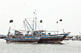
Fishing boats at the Port of Karachi
-

Karachi from space
-

Street in Karachi
-
Manora Beach


Notable Colonial Era Edifices
-
Asia House City Courts
-

City Courts
-
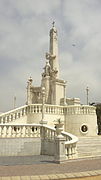
Christ the King Monument
-

Faiz-e-Hussaini Building
-

Flag Staff House
-

Governor House
-
Karachi Cantonment2
-
Karachi Chamber of Commerce
-

Khyber Hotel
-

Lotia Building
-

Max Denso Hall and Library
-

Mereweather Clock Tower
-
Mohammad Ali Building
-
Mules Mansion
-
NED Dispensary Saddar
-
Old ILACO House
-

The Sindh High Court
-

Victoria Museum
.JPG)


2.jpg)


.jpg)

See also
- Sister cities of Karachi
- List of cities with the most high-rise buildings
- List of tallest buildings in Karachi
- List of parks and gardens in Karachi
- List of cemeteries in Karachi
- List of people from Karachi
- List of largest cities in Organisation of Islamic Cooperation member countries
- List of places in Karachi
- Transport in Karachi
- List of Sindhi people
- List of streets of Karachi
- List of Urdu Speaking People
- World's largest cities
- List of cities proper by population
- List of urban areas by population
- List of metropolitan areas in Asia
- Largest cities in Asia
- Megacity
References
- ^ a b Brinkhoff, Thomas. citypopulation.de "The Principal Agglomerations of the World" Check
|url=scheme (help). City Population. Retrieved 8 April 2015. - ^ a b "Population explosion: Put an embargo on industrialisation in Karachi". http://tribune.com.pk. 6 October 2013. Retrieved 17 January 2014.
- ^ "District in Karachi". Karachi Metropolitan Corporation. Retrieved 6 May 2014.
- ^ "Administrator Office". Karachi Metropolitan Corporation. Retrieved 13 October 2015.
- ^ "Administrator Office". Karachi Metropolitan Corporation. Retrieved 13 October 2015.
- ^ "LIST OF COMMISSIONER & ADDITIONAL COMMISSIONERS". Karachi Metropolitan Corporation. Retrieved 13 October 2015.
- ^ "Government". Karachi Metropolitan Corporation. Retrieved 6 May 2014.
- ^ "Geography & Demography". City District Government of Karachi. Retrieved 22 August 2010.
- ^ "Largest cities and their mayors in 2011". City Mayors. Retrieved 5 February 2010.
- ^ "About Karachi". Karachi Chamber of Commerce and Industry. Retrieved 10 February 2014.
- ^ "Karachi > Gallery". UN-Habitat. Retrieved 10 February 2014.
- ^ "Sindh population surges by 81.5 pc, households by 83.9 pc". Thenews.com.pk. 2 April 2012. Retrieved 21 April 2013.
- ^ http://demographia.com/db-worldua.pdf
- ^ "World Urbanization Prospects, 2009 revision (online data)". Retrieved 11 May 2011.
- ^ "Pakistan City Karachi Online Information". Pakistancity.org. Archived from the original on 16 April 2010. Retrieved 6 May 2010.
- ^ "GaWC – The World According to GaWC 2008". Lboro.ac.uk. 3 June 2009. Retrieved 14 September 2009.
- ^ "GAWC World Cities Ranking List". Diserio.com. Retrieved 14 September 2009.
- ^ Dragons and Tigers: A Geography of South, East, and Southeast Asia. John Wiley & Sons. Retrieved 4 May 2012.
- ^ "Port Qasim | About Karachi". Port Qasim Authority. Retrieved 10 February 2014.
- ^ a b Rizwan – 30 October 2012 said: (30 October 2012). "Karachi: the city of lights". Pakistan Today. Retrieved 10 February 2014.
- ^ a b "Karachi city of lights". Pakobserver.net. 7 December 2012. Retrieved 10 February 2014.
- ^ a b c d "Global city GDP rankings 2008-2025". PricewaterhouseCoopers. Retrieved 12 February 2010. Cite error: Invalid
<ref>tag; name "pwc1" defined multiple times with different content (see the help page). - ^ [1] Archived December 21, 2014 at the Wayback Machine
- ^ "DAWN – Features; August 8, 2002". Dawn.Com. 8 August 2002. Retrieved 10 February 2014.
- ^ Kurrachee. Retrieved 14 June 2015.
- ^ A gazetteer of the province of Sindh. Retrieved 14 June 2015.
- ^ The Dutch East India Company (VOC) and Diewel-Sind (Pakistan) in the 17th and 18th centuries, Floor, W. Institute of Central & West Asian Studies, University of Karachi, 1993–1994, p. 49.
- ^ "The Dutch East India Company's shipping between the Netherlands and Asia 1595-1795". Retrieved 14 June 2015.
- ^ Neill, , John Martin Bladen (1846). Recollections of four years' service in the East with H.M. fortieth regiment. Retrieved 27 November 2009.
- ^ Christina P Harris (1969) The Persian Gulf Submarine Telegraph of 1864. The Geographical Journal. vol. 135(2). June. pp. 169–190
- ^ [Herbert Feldman [1970]: Karachi through a hundred years: the centenary history of the Karachi Chamber of Commerce and Industry 1860–1960. 2. ed. Karachi: Oxford UP (1960).]
- ^ Planning Commission, The Second Five Year Plan: 1960–65, Karachi: Govt. Printing Press, 1960, p. 393
- ^ Planning Commission, Pakistan Economic Survey, 1964–65, Rawalpindi: Govt. Printing Press, 1965, p. 212.
- ^ Government archives, Sindh for Municipality and divisional administration
- ^ "Afghan refugees population in Pakistan". Cambridge Journal. Journals.cambridge.org. Retrieved 6 May 2010.
- ^ a b Sharmeen Obaid-Chinoy (17 July 2009). "Karachi's Invisible Enemy". PBS. Retrieved 24 August 2010. Cite error: Invalid
<ref>tag; name "pbs" defined multiple times with different content (see the help page). - ^ a b "In a city of ethnic friction, more tinder". The National. 24 August 2009. Retrieved 24 August 2010. Cite error: Invalid
<ref>tag; name "The_National" defined multiple times with different content (see the help page). - ^ Minahan, James (2002). Encyclopedia of the Stateless Nations: Ethnic and National Groups Around the World 3. Greenwood. pp. 1277–1278. ISBN 978-0-313-32111-5.
- ^ a b c Asian Development Bank. "Karachi Mega-Cities Preparation Project" (PDF). Retrieved 1 January 2009.
- ^ "A story behind every name". The News International, Pakistan. 21 October 2009. Retrieved 14 June 2015.
- ^ The case of Karachi, Pakistan
- ^ a b c "Climate data – Karachi". Pakistan Meteorological Department, Government of Pakistan. Archived from the original on 22 April 2010. Retrieved 24 August 2010.
- ^ [2] Archived July 11, 2014 at the Wayback Machine
- ^ "WMO Climate Normals for KARACHI (AIRPORT) 1961–1990". National Oceanic and Atmospheric Administration. Retrieved 2014-03-15.
- ^ "Extremes of Karachi". Pakistan Meteorological Department. Retrieved February 2, 2015.
- ^ "Annexures" (PDF). City District Government Karachi. Retrieved 10 February 2014.
- ^ a b c d "Federal Board of Revenue Year Book 2006–2007" (PDF). Retrieved 12 April 2009.
- ^ Pakistan and Gulf Economist. "Karachi: Step-motherly treatment". Retrieved 15 October 2007.
- ^ a b Social Policy and Development Center. "Provincial Accounts of Pakistan: Methodology and Estimates". Archived from the original on 10 April 2008. Retrieved 1 January 2009.
- ^ a b Dawn Group of Newspapers. "Sindh, Balochistan's share in GDP drops". Retrieved 1 January 2009.
- ^ Dawn Group of Newspapers. "Sindh's GDP estimated at Rs 240 billion". Retrieved 1 January 2009.
- ^ Dawn Group of Newspapers. "Sindh share in GDP falls by 1pc". Retrieved 1 January 2009.
- ^ The Trade & Environment Database. "The Karachi Coastline Case". Retrieved 1 January 2009.
- ^ Dawn Group of Newspapers. "World Bank report: Karachi termed most business-friendly". Retrieved 15 October 2007.
- ^ "Pakistan: After the Crash". Businessweek. 21 April 2005. Retrieved 10 February 2014.
- ^ Thakur, Pooja (24 August 2009). "Pakistan Stocks May Advance, Credit Suisse Says (Update1)". Bloomberg. Retrieved 10 February 2014.
- ^ "Sector Overview" (PDF). Pakistan Board of Investment. Retrieved 10 February 2014.
- ^ "Information technology policy of Pakistan" (PDF). United Nations Public Administration Network. Retrieved 10 February 2014.
- ^ "Welcome to KTN TV". KTN. Retrieved 20 February 2008.
- ^ "Sindh TV". Sindh TV. Archived from the original on 2 January 2008. Retrieved 20 February 2008.
- ^ "The Federation of Pakistan Chambers of Commerce & Industry". Federation of Pakistan Chambers of Commerce & Industry. Archived from the original on 15 September 2013. Retrieved 10 February 2014.
- ^ "Full Service Interactive Agency – MAGSNET LIMITED". Epb.gov.pk. Archived from the original on 12 January 2014. Retrieved 10 February 2014.
- ^ "Welcome To S.I.T.E Association of Industry of Karachi". Site-association.org. Retrieved 10 February 2014.
- ^ "Welcome". Korangi Association of Trade & Industry. Retrieved 10 February 2014.
- ^ "Landhi.Org". Landhi Association of Trade and Industry. Retrieved 10 February 2014.
- ^ "North Karachi Association of Trade & Industry". North Karachi Association of Trade & Industry. Retrieved 10 February 2014.
- ^ "Federal B Area Association of Trade & Industry". Federal B Area Association of Trade & Industry. 17 December 2013. Retrieved 10 February 2014.
- ^ APP (20 November 2013). "Construction approved: Korangi Creek Industrial Park land up for grabs – The Express Tribune". Tribune.com.pk. Retrieved 10 February 2014.
- ^ "BQATI {Bin Qasim Association of Trade & Industry}". Bin Qasim Association of Trade & Industry. Retrieved 10 February 2014.
- ^ "Export Processing Zone Authority". Pakistaneconomist.com. Retrieved 10 February 2014.
- ^ "Welcome To EPZA". Epza.gov.pk. Retrieved 10 February 2014.
- ^ "Textile City". Textile City. Retrieved 10 February 2014.
- ^ a b "site.com.pk". Sindh Industrial Trading Estates. Retrieved 10 February 2014.
- ^ "Business | Pakistan agrees $43bn development". BBC News. 28 September 2006. Retrieved 10 February 2014.
- ^ Karachi Port Trust. "K.P.T. Projects". Archived from the original on 24 March 2006. Retrieved 17 April 2006.
- ^ Dawn Group of Newspapers. "KPT to build Rs 20bn tower complex". Retrieved 20 April 2006.
- ^ Hamdard University Project Office (12 October 2006). "Port Tower Complex, Karachi". Kpt.gov.pk. Retrieved 6 May 2010.
- ^ a b c d e "CDGK History". City-District Government of Karachi. Retrieved 24 August 2010.
- ^ "Pakistan Provinces". Statoids.com. Retrieved 24 August 2010.
- ^ "CDGK Towns". City District Government of Karachi. Retrieved 24 August 2010.
- ^ "Local Government". National Reconstruction Bureau, Government of Pakistan. Retrieved 24 August 2010.
- ^ "Composition of the Union Council". National Reconstruction Bureau, Government of Pakistan. Retrieved 24 August 2010.
- ^ "Tehsil and Town Councils". National Reconstruction Bureau, Government of Pakistan. Retrieved 24 August 2010.
- ^ "Zila Council". National Reconstruction Bureau, Government of Pakistan. Retrieved 24 August 2010.
- ^ "Korangi notified as sixth district of Karachi".
- ^ "Korangi made sixth district of Karachi".
- ^ "Sindh back to 5 divisions after 11 years".
- ^ Aligi, Irfan. "Changing hands: Karachi split into 5 districts – The Express Tribune". Tribune.com.pk. Retrieved 10 February 2014.
- ^ "Welcome to official website of Karachi Metropolitan Corporation". Kmc.gov.pk.sv2.premiumwebserver.com. Retrieved 10 February 2014.
- ^ "Administrator Karachi". Kmc.gov.pk.sv2.premiumwebserver.com. Retrieved 10 February 2014.
- ^ "Metropolitan Commissioner". Kmc.gov.pk.sv2.premiumwebserver.com. Retrieved 10 February 2014.
- ^ "Home Page - Commissioner Karachi". Retrieved 14 June 2015.
- ^ a b "The Urban Frontier—Karachi". NPR. 2 June 2008. Retrieved 17 January 2010.
- ^ "Karachi population to hit 27.5 million in 2020". Dawn. 10 July 2007. Retrieved 24 August 2010.
- ^ "Karachi turning into a ghetto". Dawn. 16 January 2006. Archived from the original on 7 January 2010. Retrieved 24 August 2010.
- ^ "Population of Hindus in the World". http://pakistanhinducouncil.org. Retrieved 21 April 2013.
- ^ "Urban Resource Centre". Urckarachi.org. Retrieved 21 April 2013.
- ^ "Population size and growth of major cities". Population Census Organization, Government of Pakistan. Retrieved 24 August 2010.
Note: The 1998 census showed a population of about 9 million but this did not include workers living in Karachi but registered as living elsewhere in Pakistan by the National Database and Registration Authority as well as large numbers of Afghan refugees, Bangladeshis, Indians, Nepalis and others (incl. Filipinos, Iranians, Iraqis, Burmese). - ^ a b "Political and ethnic battles turn Karachi into Beirut of South Asia " Crescent". Merinews.com. Retrieved 24 November 2012.
- ^ "Falling back". Daily Times. Archived from the original on 5 August 2011. Retrieved 24 August 2010.
- ^ "Chronology for Biharis in Bangladesh". Center for International Development and Conflict Management, University of Maryland. 10 January 2007. Retrieved 6 May 2010.
- ^ "From South to South: Refugees as Migrants: The Rohingya in Pakistan". Huffington Post. 12 May 2008. Retrieved 24 August 2010.
- ^ Bengali and Rohingya leaders gearing up for LG polls
- ^ "Sheedis have been hurt most by attitudes". Dawn. 23 June 2008. Retrieved 24 August 2010.
- ^ a b "Conflicted Karachi | The Dawn Blog | Pakistan, Cricket, Politics, Terrorism, Satire, Food, Culture and Entertainment". Blog.dawn.com. 26 August 2010. Retrieved 10 February 2014.
- ^ Ramzi, Shanaz (9 July 2001), "The melting pot by the sea", Dawn, archived from the original on 15 July 2004, retrieved 26 July 2009
- ^ "Warsaw Business Journal – Online Portal". wbj.pl. 13 June 2011. Retrieved 10 February 2014.
- ^ The Exile Mission. Retrieved 14 June 2015.
- ^ "After Slayings, Americans in Karachi Weigh Choices – Los Angeles Times". Articles.latimes.com. 12 June 2009. Retrieved 10 February 2014.
- ^ "Columnists | The Pakhtun in Karachi". Time. 28 August 2010. Retrieved 2011-09-08.
- ^ a b [3], thefridaytimes
- ^ "UN body, police baffled by minister’s threat against Afghan refugees". Dawn Media Group. 2009-02-10. Retrieved 2012-01-24.
- ^ M R Narayan Swamy (5 October 2005). "Where Malayalees once held sway | Latest News & Updates at". Dnaindia.com. Retrieved 10 February 2014.
- ^ "Karachi". Findpk.com. Archived from the original on 14 October 2013. Retrieved 10 February 2014.
- ^ "Karachi Online". HamaraKarachi. Retrieved 10 February 2014.
- ^ National Academy of Performing Arts. "Welcome to National Academy of Performing Arts". Retrieved 17 April 2006.
- ^ "All Pakistan Music Conference | Established in 1959". All Pakistan Music Conference. Retrieved 10 February 2014.
- ^ "Heritage Revisited". Historickarachi.com. Archived from the original on 22 August 2008. Retrieved 26 August 2010.
- ^ "Public Arch 5". Historickarachi.com. Archived from the original on 24 October 2007. Retrieved 26 August 2010.
- ^ "Public Architecture". Historickarachi.com. Archived from the original on 15 April 2008. Retrieved 26 August 2010.
- ^ "Culture department takes notice of Freemason Lodge Building". Daily Times. Archived from the original on 5 August 2011. Retrieved 16 January 2009.
- ^ "Nusserwanjee Building (Relocation) Project". Daily Times. Retrieved 26 February 2013.
- ^ "MCB Tower, the tallest skyscraper of Karachi". Mcb.com.pk. Retrieved 6 May 2010.
- ^ Downey, Jake (2003). Better Badminton for All. Pelham Books. p. 13. ISBN 0720702283.
- ^ "Test Matches played on National Stadium, Karachi". Cricket Archive. Retrieved 26 August 2010.
- ^ "First-Class matches played by Karachi". Cricket Archive. Retrieved 26 August 2010.
- ^ "First-Class matches played by Karachi Blues". Cricket Archive. Retrieved 26 August 2010.
- ^ "First-Class matches played by Karachi Greens". Cricket Archive. Retrieved 26 August 2010.
- ^ "First-Class matches played by Karachi Whites". Cricket Archive. Retrieved 26 August 2010.
- ^ "Fixtures". ESPNcricinfo. Retrieved 26 August 2010.
- ^ "National Games". Pakistan Sports Board. Retrieved 26 August 2010.
- ^ Ian Colbeck, Zaheer Ahmad Nasir and Zulfiqar Ali. "The state of ambient air quality in Pakistan—a review". Retrieved 15 July 2010.
- ^ "Lyari Expressway (South Bound) Inaugurated : ALL THINGS PAKISTAN". Pakistaniat.com. Retrieved 21 April 2013.
- ^ "Thar Express escapes blast near Karachi". GEO.tv. 4 December 2010. Retrieved 21 April 2013.
- ^ http://piac.aero
- ^ "Projects". Karachi Port Trust. Archived from the original on 21 October 2007. Retrieved 19 November 2007.
- ^ "News | Business News | Current News | Latest World News | Current World News | Pakistan News". Brecorder.com. Retrieved 10 February 2014.
External links
| Definitions from Wiktionary | |
| Media from Commons | |
| News stories from Wikinews | |
| Quotations from Wikiquote | |
| Source texts from Wikisource | |
| Textbooks from Wikibooks | |
| Travel guide from Wikivoyage | |
| Learning resources from Wikiversity | |
|