Welcome to Canada’s Maritime Information Portal
This portal gives mariners access to all the official electronic data and services needed to plan a voyage in Canada, including marine weather, tides, currents, hazards, notices, ice conditions, charts and sailing directions.
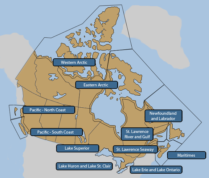
Navigation by region
Marine Navigation Data
Catalogue

Find available datasets and web services directly from our Data Catalogue.
You can filter the results by category, navigation area or keyword.
Map - Coming soon.

View and interact with maritime services on our interactive map. You can zoom, pan, show or hide layers, and query
data directly using this Geographic Information System.
All the information on this site is available under the Open Government Licence of Canada. For more information about the Maritime Information Portal, please refer to the About This Portal and F.A.Q. sections.
- Date modified: